Multi-layer assessment
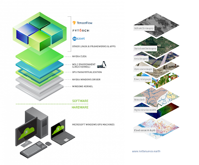
Bulks of environmental Open-Data are available nowadays, as well as many software and hardware frameworks to work with. Our 15 years experience in multi-layered data allows to search for optimal solutions and tools to scale your exploitation needs, particularly for input quality checking involved in large scale flood modelling and drone imagery processing. Image compilation sources: nvidia.com left, and iceye.com right.