And third summer view
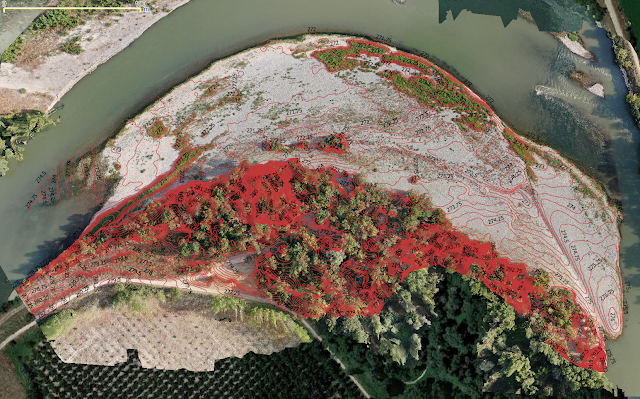
To finish this summer compilation, a few numbers to highlight how feasible is to track the evolution of a meander: for a pilot case 10 Hectares surface, 15 mins drone footage in manual mode can take 200 snapshots, and after 2 hours SfM crunching by a desktop, a 3D surface model with centimetrical pixel resolution (GSD < 5 cms) allows to track standard fluvial shapes: bars, channels and other deposits that identify meander migrations. More details discussed in the next season E-Learning module.

