Survey during the flood
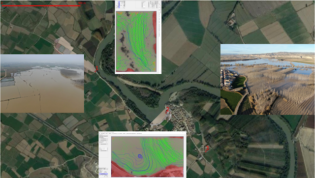
During the flood peak and afterwards is essential to track water levels, boundaries and flow speeds, all assisted by drone. This data is needed to interpret and validate Satellite Imagery, mainly the non-visible SAR from Sentinel-1. Look here 3 survey points we observed during the last flood at Mid-Ebro.
Comments
Post a Comment