Reporting meander bed change
During one seminar I was asked how bed level changes after a major flood. Quick answer with drone imagery:
the top picture is from October-2021 and the bottom one from March-2022, with a major flood in between: December-2021. Shapes and volumes can be tracked down accurately processing the digital terrain models.
Google-Sat background at Alcalá de Ebro.
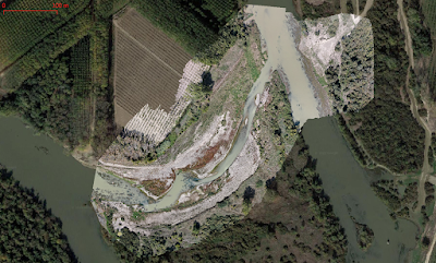 |
| October 2021 |
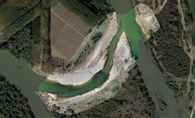 |
| March 2022 |


Comments
Post a Comment