Posts

Cost-effective remote sensing-EO data processing for floods
Image
  A first approach with local High Resolution UAV datasets, open-access Satellite Imagery and Free Software processing tools was made for UTN-Concordia, Argentina, last May and April, during six online sessions. Many comments and feedback have led to a redistribution of the modules, as explained in the new leaflet for future editions. The basic Educational Module covers the tools: Open-Drone-Map WebODM, RIVeR-LSPIV, HEC-RAS, Google-Earth-Engine and QGIS . Imagery data come from local drone surveys and Copernicus Sentinel -1, 2 satellite missions.  

Drone Saturdays

Image
First edition online drone imagery processing with free software, course already launched last Saturday 10th April, hosted by UTN Concordia, Entre RĂ­os, Argentina, a region with large water resources to be monitored in detail with remote sensing tools. How can drones assist with 3D image reconstruction and mapping, to be discussed along 4 hours practices during six saturdays.  

Digital rivers

Image
Introducing  the use of satellites, drones and new generation software solutions for wider and easy access monitoring in hydrology,   for the online Master IRH@unizar , January 13th, 2021.     

Aligned with Sendai 2030

Image
Supporting the Sendai Framework for Disaster Risk Reduction. Related to targets F and G , contact for independent criteria to  evaluate implementation, capacity building, role of free software, and maintenance strategies for Multi-Hazard Early-Warning-Systems, including potential impact on local market-creation. 

Drone Mapping: the value of local level

Image
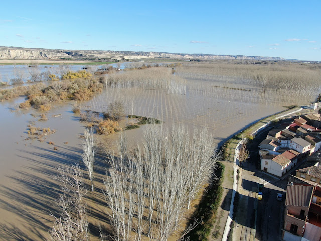
Besides increasing availability and fast delivery of Satellite Imagery Data within cloud services, a local drone footage which allows for fine resolutions (cms) and 3D views is frequently needed: the case of monitoring river bank stability and evolution to maintain flood resilience.  We offer design of surveys, and image processing training for drones to monitor flood breaches , all based in free software. At this moment only by remote sessions.      

Warming up GEE scripts:

Image
  Selecting Google-Earth-Engine basic functions and study cases for  Online Training . More information about When & How-To coming soon. function AddBand_NDWI(image) { var ndwi = image.normalizedDifference(['B2', 'B12']).rename('ndwi') // Blue-SWIR .clip(Ebro); return image.addBands([ndwi]); } function OverThreshold(image) { var F1=image.gte(WetThreshold); var F2=image.mask(F1); return F2; }

Summer news:

Image
During the last months  online support became  very intense: Advice continued for young postgrads from Argentinian universities: IHLLA-UNL, UNLPam, UNICEN and FAUBA .  Dealing with several subjects: digital elevation models by drone, long term simulations of marshes, urban river flooding and risk management. Once their dissertations are made open to the public, corresponding links will appear. Agreement for the application of Green Technology to prevent Geohydrological events in PerĂº, leading CDU-Australia , link at Research-Gate . Other interesting news: Online water resources course:  MIRH , University of Zaragoza, is re-launched. Virtual attending to "state of the art conference" River-Flow 2020 , July 6-10, Delft.